Learn the map
Map projections and distortion: shape, area and distance
A flat map makes a choice about distortion. Before comparing sizes or measuring a line, ask which property the map was designed to preserve.
On this page
Why does a flat map distort Earth?
A projection translates positions on Earth’s curved surface to a flat map. That translation cannot keep every length, angle and area correct everywhere. The useful question is what the map preserves and where. A projection chosen for a world overview may be a poor choice for measuring distances around one city.
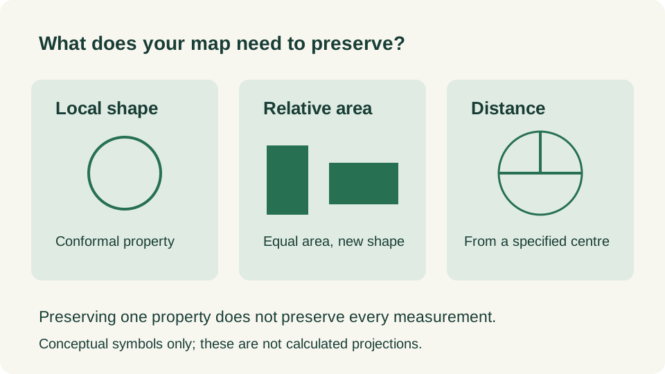
Compare the properties, not just the outlines
| Property or family | Useful for | Check before assuming |
|---|---|---|
| Conformal | Keeping local angles and small shapes | Areas and long distances can change substantially. |
| Equal area | Comparing the relative areas of regions | Angles and shapes may look stretched. |
| Equidistant | Specified distances, such as from a chosen centre | It does not preserve every distance between every pair. |
| Compromise | An overall world view with balanced distortion | It does not make all measurements exact. |
Why Mercator changes apparent size
Mercator’s increasing stretch away from the Equator can make high-latitude regions look much larger than expected. A familiar outline is therefore not reliable evidence for an area ranking. Web mapping software may also calculate distances separately from the displayed pixels. The picture and a geographic measurement are different things.
If you want to compare land area, choose an appropriate equal-area view or a sourced numerical area table. If you want distance, check the method and the region where it is valid. Do not count screen pixels, compare label sizes, or assume an ordinary straight line on a world map is the shortest route on Earth.
A practical map-reading check
- Name your task: locate a country, compare areas, or measure distance.
- Look for the projection, extent and any stated scale or measurement method.
- Check the property relevant to that task. Equal area does not mean equal distance.
- Treat separated map edges carefully. Nearby places across the antimeridian can appear on opposite sides of a world view.
- Use a globe or an appropriate geographic calculation if the flat picture cannot support the comparison.
How to use MapRounds maps
MapRounds maps support identifying places and practising their positions. Small places may use representative markers, and physical features may use simplified lines. Read each map’s note and quiz selection rule. Neither a marker’s size nor a simplified outline measures the area of a country. Quiz printouts retain those learning conventions when moved onto paper.
Combine the legend, coordinates and neighbouring features when learning a location. For a real measurement exercise, use a map that provides a suitable scale and explains its projection. The separate scale calculator shows the arithmetic for a stated ratio; it does not correct a picture for projection distortion.
Practice and check your answers
| Question | Answer and reason |
|---|---|
| A country looks twice as large on one world map. Has its land area changed? | No. Projection, scale or image resizing can change the display. |
| An equal-area map preserves area. Can every distance also be measured exactly? | No. Preserving area does not preserve all distances. |
| An equidistant map preserves distance from its centre. What about two other points? | Check the projection: that promise does not automatically cover their distance. |
| Can a quiz marker tell you how large an island is? | No. It identifies a representative location. |
| Why can two nearby points appear on opposite map edges? | A world map has a cut; the globe continues across it. |
Try a related quiz
Sources and further reading
Original MapRounds editorial text and diagrams: CC BY 4.0. Third-party source text and flag artwork retain their own terms; see the source and asset records.