Learn the map
The Netherlands vs. Holland
North Holland and South Holland are two provinces of the Netherlands. “Holland” is a common informal name for the country, but the two names do not cover the same area.
On this page
Holland is part of the Netherlands
Use “the Netherlands” when naming the country. North Holland and South Holland are two of the twelve provinces in its European part. People often use “Holland” informally for the whole country, but a province map makes the difference clear.
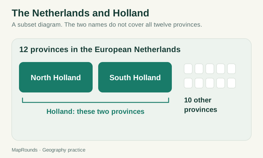
Suppose a map highlights the country beside Belgium and Germany. The country answer is the Netherlands. A question about North Holland asks for a province within it. The familiar nickname does not change which kind of place the question needs.
The country and the Kingdom are different too
The Kingdom of the Netherlands has four constituent countries: the Netherlands, Aruba, Curaçao and Sint Maarten. The country of the Netherlands includes both its European part and the Caribbean public bodies Bonaire, Sint Eustatius and Saba. The twelve-province diagram covers the European part only.
| Name | Scope in this lesson |
|---|---|
| North Holland and South Holland | Two provinces in the European Netherlands |
| The Netherlands | A constituent country of the Kingdom, including a European and a Caribbean part |
| Kingdom of the Netherlands | The Netherlands, Aruba, Curaçao and Sint Maarten |
Try it
- 1. If two provinces are called North Holland and South Holland, how many of the twelve European provinces are outside that pair?
- 2. Does the word Holland precisely name all twelve provinces?
- 3. Sort these labels by level: North Holland, the Netherlands, the Kingdom of the Netherlands.
- 4. Does a twelve-province diagram prove that the country of the Netherlands has no Caribbean component?
Check your answers
- 1. Ten. The diagram’s two highlighted tiles are a subset of twelve.
- 2. No. Holland names the pair in this lesson, even though people sometimes use it informally for the whole country.
- 3. Province; constituent country; Kingdom. The labels describe different extents.
- 4. No. The diagram shows the European provinces only. It does not show the whole country.
Use the distinction while practicing
Find the Netherlands in the Europe quiz, then check its neighbors. When you move on to provinces or Caribbean geography, read the new question carefully: a familiar name may refer to a different part of the map.
Try a related quiz
Sources and further reading
Original MapRounds editorial text and diagrams: CC BY 4.0. Third-party source text and flag artwork retain their own terms; see the source and asset records.