Learn the map
Equator, prime meridian and hemispheres: practice with coordinates
Use the latitude sign for north or south and the longitude sign for east or west. Boundary points need a more careful answer than a four-quadrant shortcut.
On this page
Start with the two zero lines
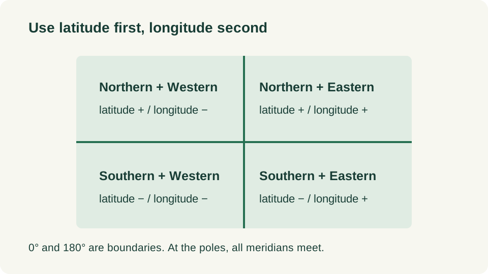
The Equator is 0° latitude and separates the Northern and Southern Hemispheres. The prime meridian is 0° longitude; together with the opposite 180° meridian it marks the east–west split used in this lesson. These are reference lines, not country borders. A point can belong to one north–south half and one east–west half at the same time.
Read each coordinate separately
| Practice point: latitude, longitude | North or south | East or west |
|---|---|---|
| 20°, 30° | Northern | Eastern |
| 20°, −30° | Northern | Western |
| −20°, 30° | Southern | Eastern |
| −20°, −30° | Southern | Western |
- Read latitude first and compare it with zero. A positive value is north of the Equator; a negative value is south.
- Read longitude separately. Positive values are east of zero longitude; negative values are west.
- Check for zero, 180° longitude or a pole before assigning a quadrant.
- State that this answer describes the point. A country or continent can extend across a boundary.
Zero, 180 degrees and the poles
At 0° latitude, a point is on the Equator rather than strictly north or south. At 0° longitude, it is on the prime meridian rather than strictly east or west. At 180° longitude, the labels 180° E and 180° W describe the same meridian. At the North or South Pole, all meridians meet, so changing longitude does not select a new surface point. Do not force these cases into one of the four open quadrants.
The International Date Line lies near the antimeridian but bends around political boundaries. A longitude alone therefore cannot determine a local calendar date or time zone. Also distinguish the historic meridian marker at Greenwich from modern geodetic reference systems; this lesson is a reading convention, not a surveying instruction.
A representative point is not a whole region
Suppose a practice record assigns a country a point at 5° N, 20° E. You can classify that point as Northern and Eastern. That single record does not prove every island or all of the country’s land lies in those two halves. In a quiz, first check whether the prompt asks about a coordinate, an entire territory or a named region. Regional browsing labels and hemisphere labels answer different questions.
Practice and check your answers
| Question | Answer and explanation |
|---|---|
| Which halves contain the point −12°, −75°? | Southern and Western under the 0°/180° convention. |
| Is 0°, 25° in the Northern Hemisphere? | It is on the Equator; 25° E places it east of the prime meridian. |
| Do 180° E and 180° W mark different meridians? | No. They meet at the same antimeridian. |
| Can you determine a country’s full extent from one quiz marker? | No. You need its boundaries, including any separate territories. |
| Is a point at 90° N, 60° E farther from the North Pole than 90° N, 0°? | No. Both describe the North Pole. |
On a world quiz, use the Equator as a broad orientation cue, then use coastlines and neighbouring places to refine the answer. Try continents before individual countries if the whole map still feels unfamiliar. Some maps use different east–west hemisphere boundaries, so always read the stated convention.
Try a related quiz
Sources and further reading
- oceanservice.noaa.gov
- oceanservice.noaa.gov
- education.nationalgeographic.org
- education.nationalgeographic.org
Original MapRounds editorial text and diagrams: CC BY 4.0. Third-party source text and flag artwork retain their own terms; see the source and asset records.