Flags of Oceania
Explore the flags of 14 countries in Oceania. Learn their patterns and emblems, test yourself or print a worksheet to practice offline.
About this selection14 places included
14 UN member states in the Oceania set. Flag designs follow the locally stored flag-icons 7.6.0 artwork.
How this set is defined
Country quizzes use the 193 UN member states. The Holy See and the State of Palestine are non-member observer states and are not included. Each member appears in one regional set: Russia and Cyprus are in Europe; Türkiye, the Caucasus states and Kazakhstan are in Asia. North America includes Central America and the Caribbean. These groupings define the quiz, not a position on statehood or disputed borders.
Not included
- The Holy See (UN non-member observer State)
- The State of Palestine (UN non-member observer State)
- Other non-member entities
- Dependent territories as separate answers
Last scope review:
Open the full answer listOptional. Saves in this browser, on this device.
Study this set
Study the map and its labels before trying a quiz. Outlines are simplified; see the map notes for details.
This image could not load. Try again or use the answer list below.
Map and keyboard help
Tab to a place, then press Enter or Space to select it. With a place focused, use the arrow keys to pan, + and − to zoom, and 0 to reset the view.
For small places, use the named list instead of trying to tap the outline.
Identifying a highlighted shape or a flag requires seeing the image. For map questions with named text choices, choose Find a named place.
Generalized Natural Earth geography; public domain. Coordinate projection is an equirectangular study view with standard-parallel scaling. Boundaries are not a political-status claim. Longitudes are wrapped across 180° so Pacific island groups remain together. Small or unrepresented polygons use explicitly marked representative points. Use the text list as an equivalent answer method.
Dots help you find small places. They mark a location, not the full outline or size of a place.
Read the guideStudy this set
Look at the layout of each flag before studying smaller emblems. Learn a few at a time instead of memorizing the whole list in order.
Enlarge designs with small symbols, then test yourself with the labels hidden. Review any pair that still looks alike.
Places and answers
Name the country represented by the flag shown. The images follow flag-icons 7.6.0 and may use a particular design variant; see the notes below. Listed country names and aliases are accepted.
| Place | Flags | Accepted names | Place notes |
|---|---|---|---|
| Australia | 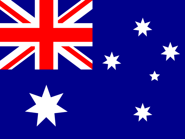 | Australia | Included in this site’s 193 UN member-state set. Map outlines are simplified. |
| Federated States of Micronesia | 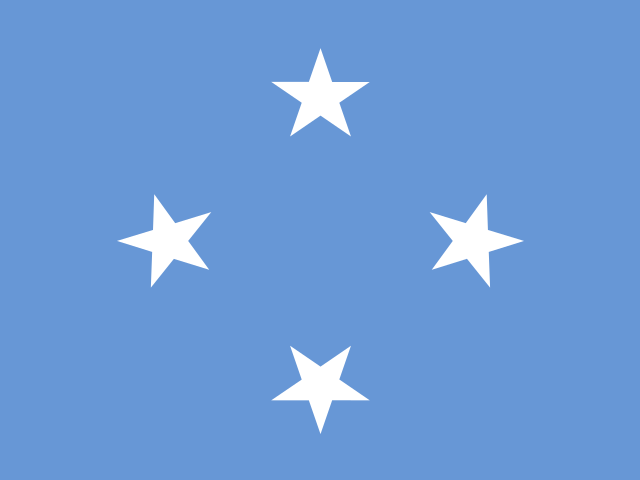 | Federated States of Micronesia; Micronesia | Included in this site’s 193 UN member-state set. Map outlines are simplified. |
| Fiji | 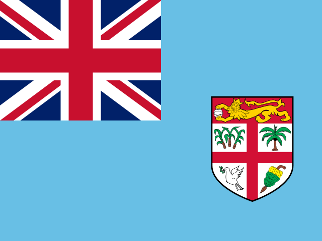 | Fiji | Included in this site’s 193 UN member-state set. Map outlines are simplified. Fiji crosses the 180° meridian; the Oceania view wraps longitudes to keep its islands together. |
| Kiribati | 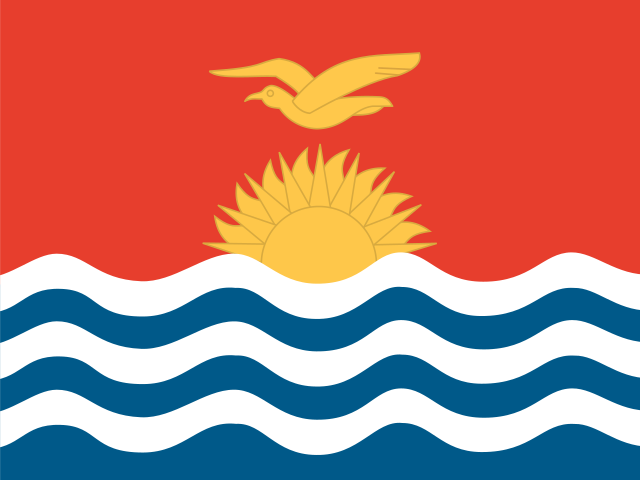 | Kiribati | Included in this site’s 193 UN member-state set. Map outlines are simplified. |
| Marshall Islands | 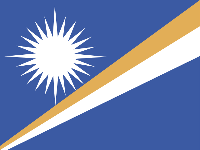 | Marshall Islands | Included in this site’s 193 UN member-state set. Map outlines are simplified. |
| Nauru | 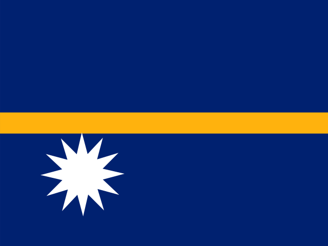 | Nauru | Included in this site’s 193 UN member-state set. Map outlines are simplified. |
| New Zealand | 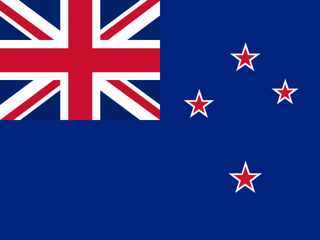 | New Zealand | Included in this site’s 193 UN member-state set. Map outlines are simplified. |
| Palau | 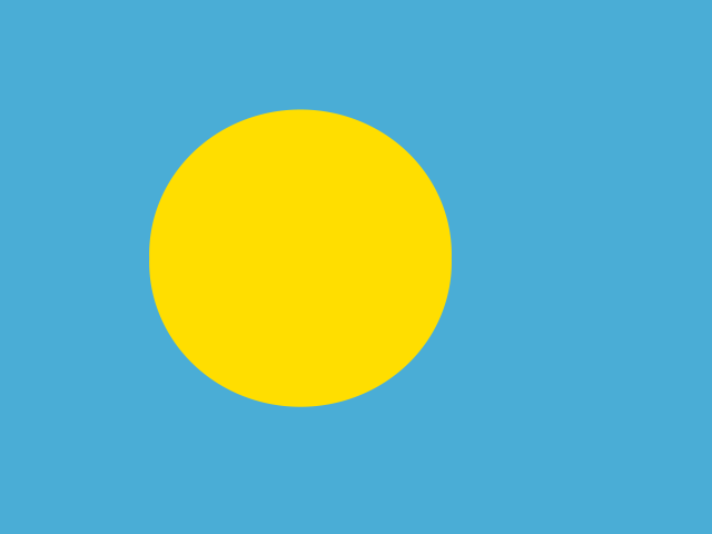 | Palau | Included in this site’s 193 UN member-state set. Map outlines are simplified. |
| Papua New Guinea | 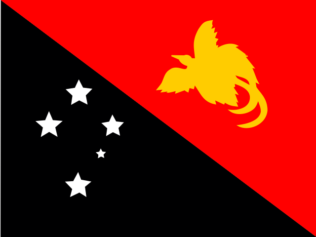 | Papua New Guinea | Included in this site’s 193 UN member-state set. Map outlines are simplified. |
| Samoa | 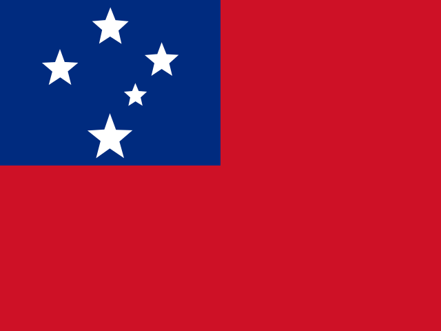 | Samoa | Included in this site’s 193 UN member-state set. Map outlines are simplified. |
| Solomon Islands | 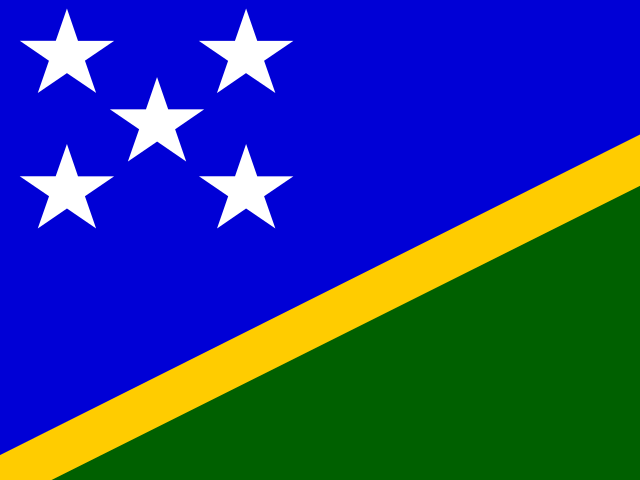 | Solomon Islands | Included in this site’s 193 UN member-state set. Map outlines are simplified. |
| Tonga | 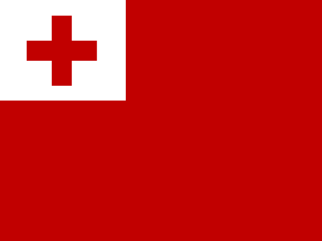 | Tonga | Included in this site’s 193 UN member-state set. Map outlines are simplified. |
| Tuvalu | 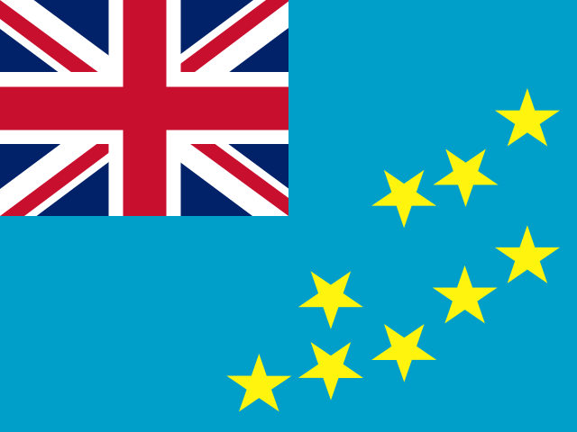 | Tuvalu | Included in this site’s 193 UN member-state set. Map outlines are simplified. |
| Vanuatu | 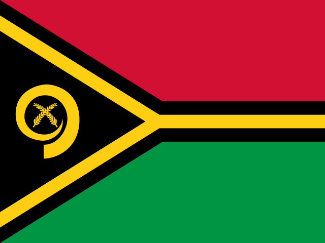 | Vanuatu | Included in this site’s 193 UN member-state set. Map outlines are simplified. |
Sources and map notes
equirectangular; regional standard parallel; US inset transforms when stated. Generalized Natural Earth geography; public domain. Coordinate projection is an equirectangular study view with standard-parallel scaling. Boundaries are not a political-status claim. Longitudes are wrapped across 180° so Pacific island groups remain together. Small or unrepresented polygons use explicitly marked representative points. Use the text list as an equivalent answer method.
- United Nations current Member States
- Natural Earth vector data
- GeoNames country information
- flag-icons local 4:3 SVG flags
- UN non-member observer States
Last scope review: 2026-10-21
Methods & sources