Learn the map
Canada’s provinces, territories and capitals
Canada has 10 provinces and three territories. Learn where all 13 are, then practice matching them with their capitals.
On this page
Canada has 10 provinces and three territories
The three territories are Yukon, Northwest Territories and Nunavut. The other ten places in this set are provinces. A quiz called “provinces and territories” includes both groups, so calling all thirteen provinces misses an important distinction.
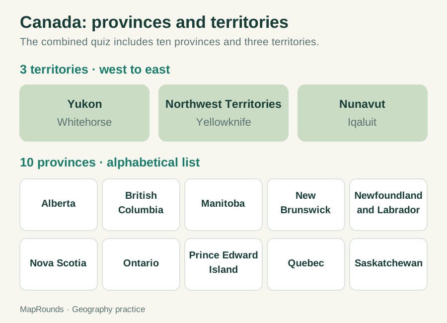
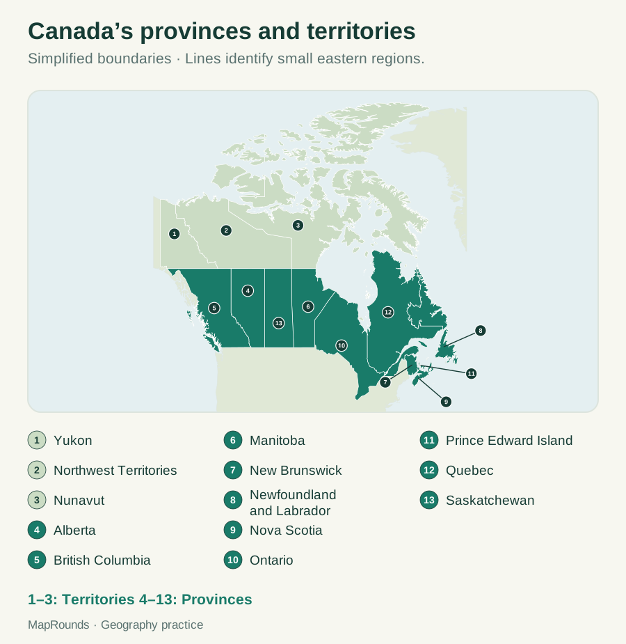
Start with the three northern territories
From west to east, find Yukon, Northwest Territories and Nunavut across northern Canada. Then work through the provinces to the south and east. Use this broad order to get started, and return to the full map to study the coastlines and boundaries.
Keep each province or territory separate from its capital city. Ottawa is Canada’s national capital, but that does not make it the answer to a question about a provincial capital. Read which place the question names before choosing a city.
| Province or territory | Category | Capital |
|---|---|---|
| Alberta | Province | Edmonton |
| British Columbia | Province | Victoria |
| Manitoba | Province | Winnipeg |
| New Brunswick | Province | Fredericton |
| Newfoundland and Labrador | Province | St. John’s |
| Nova Scotia | Province | Halifax |
| Ontario | Province | Toronto |
| Prince Edward Island | Province | Charlottetown |
| Quebec | Province | Québec City |
| Saskatchewan | Province | Regina |
| Northwest Territories | Territory | Yellowknife |
| Nunavut | Territory | Iqaluit |
| Yukon | Territory | Whitehorse |
Build up to the capital pairs
- Locate the three territories with labels visible. Say each territory name while checking its position.
- Choose a small neighboring group of provinces and locate those. Use the full map to check relationships that the tile diagram simplifies.
- Once you can locate a province or territory, learn its capital. A two-column note such as “Yukon → Whitehorse” keeps the pair together.
Try it
- 1. Classify Nunavut, Ontario, Yukon and British Columbia as provinces or territories.
- 2. Complete the count: ten _____ plus three _____ equals thirteen units in this set.
- 3. Match Yukon, Northwest Territories and Nunavut with Iqaluit, Whitehorse and Yellowknife.
- 4. A question asks for Ontario’s capital. Should you answer Ottawa because it is Canada’s national capital?
Check your answers
- 1. Nunavut and Yukon are territories. Ontario and British Columbia are provinces.
- 2. Provinces; territories.
- 3. Yukon → Whitehorse; Northwest Territories → Yellowknife; Nunavut → Iqaluit.
- 4. No. Ontario’s provincial capital is Toronto. Ottawa answers the different question about Canada’s national capital.
Try a related quiz
Sources and further reading
Original MapRounds editorial text and diagrams: CC BY 4.0. Third-party source text and flag artwork retain their own terms; see the source and asset records.